| Image | Lot | Price | Description |


|
1467
|
$144.00
|
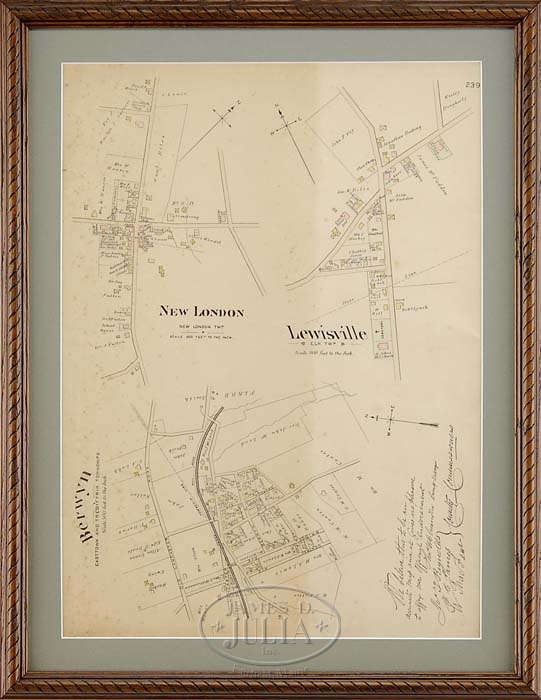
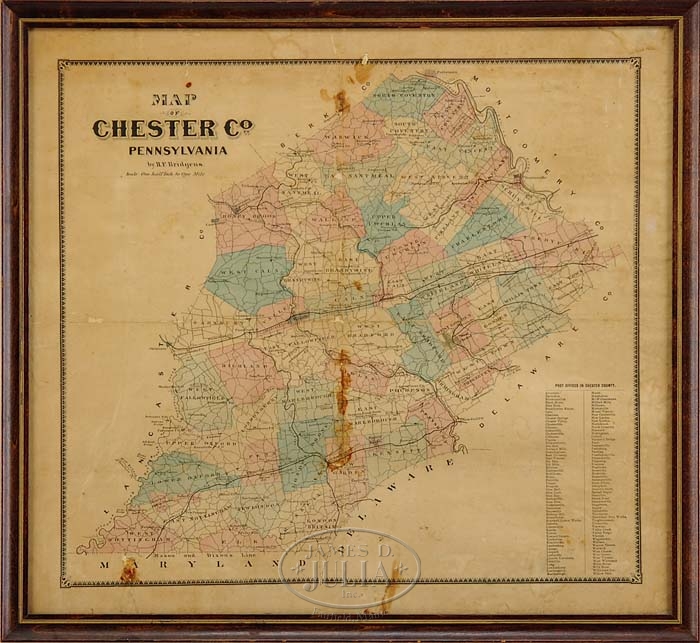
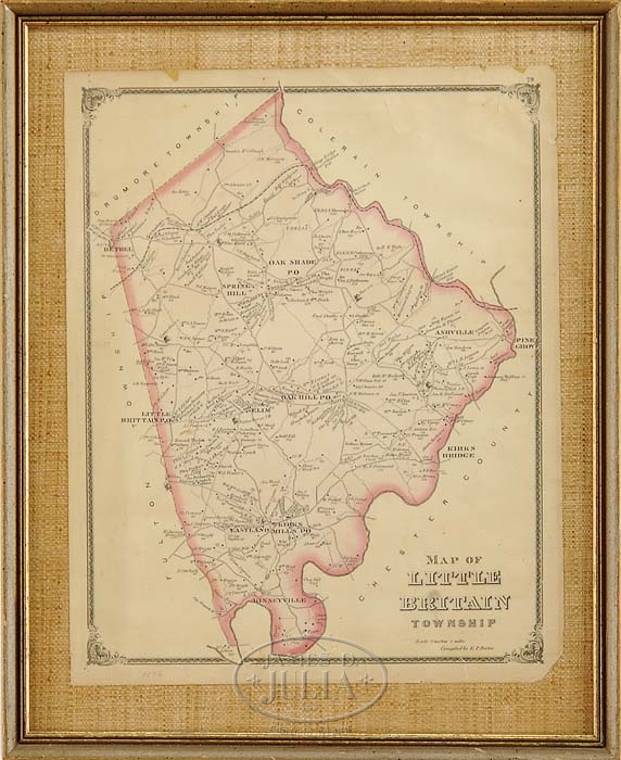
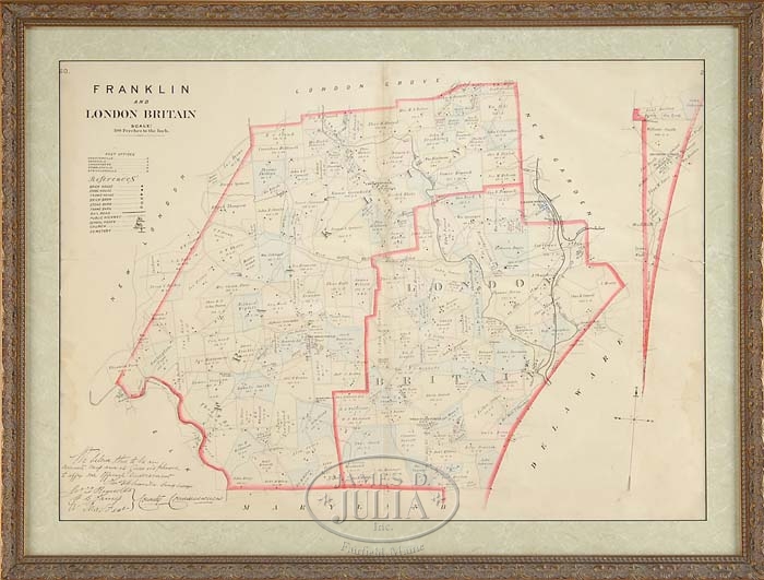
LOT OF SIX FRAMED ANTIQUES MAPS. 1) 17″ x 13-1/2″ map of Little Britain Township by EP Porter. A page from an 1876 atlas. 2) 17″ x 10″ map of the middle states dated 1839 from Mitchells School and Family Geography. 3) 20″ x 14-1/2″ map of Easttown and Tredyffrin Townships including New London, Lewisville and Berwyn showing streets and building with names. 4) 21″ x 23″ map of Chester County, Pennsylvania by H. F. Bridgens. Not dated but 19th Century showing folds and deterioration at folds with all over toning. 5) 19-1/2″ x 27-1/4″ map of Franklin and London Britain. 6) 39″ x 33-1/2″ map of Franklin’s Plat map of Delaware County by the Franklin Survey Company. SIZE: All sizes noted above are sight size. CONDITION: As noted above, otherwise fair to good with visible folds. 9-91723 (200-400)
Auction: Fine Art, Antiques & Asian - Winter 2008 Please Note: All prices include the hammer price plus the buyer’s premium, which is paid by the buyer as part of the purchase price. The prices noted here after the auction are considered unofficial and do not become official until after the 46th day. |