| Image | Lot | Price | Description |


|
3229
|
$4,312.50
|
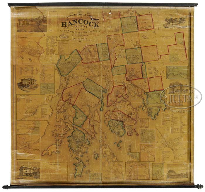
GROUP OF SIX SCHOOLROOM WALL MAPS. 1) Map of the State of Maine with the Province of New Brunswick by Moses Greenleaf, engraved by J.H. Young & F. Dankworth, Philadelphia. Published by Shirley & Hyde, Portland, 1829. Wall map showing Maine with colored counties. 2) United States 1921 map by the Dept. of Interior. 3) Topographical map of Hancock County, Maine by H.F. Walling, 1860. Wall map showing colored sections of the county surrounded by smaller maps of individual towns and engraved panels of important places. 4) Colton’s Map of the United States including the British provinces, inset map of Central America by D. McLellan, New York, and the West Indies. Wall map showing the United States. Published by J.H. Colton, 1854. 5) Map of Mt. Desert Island, Maine 1896 by Waldron Bates, Edward L. Rand, and Herbert Jaques. Map showing the island with its roads, lakes & surrounding islands. 6) Map of the City of Ellsworth, Maine by Roe & Colby, 1875. The colored city map showing the different wards with houses & streets, very colorful. SIZE: 1) 50″ h x 42″. 2) 62″ h x 85″ w. 3) 62″ h x 63″ w. 4) 54″ h x 60″ w. 5) 52″ h x 43-1/2″ w. 6) 48″ h x 43″ w. PROVENANCE: From an Ellsworth, Maine Estate. CONDITION: 1) Intact with toning, some stains, wrinkling with some tears, in need of some restoration. 2) Intact with some stains. 3) Some stains & yellowing, some tears at top center. 4) Some crease marks, tears & damaged edges. 5) Very good with some light stains at edges and a few tears at bottom left margin. 6) The top 12″ damaged with stains, creases, tears. The remainder very good with bottom stain. 9-21974 (1,000-2,000)
Auction: Fine Art, Antiques & Asian - August 2011 Please Note: All prices include the hammer price plus the buyer’s premium, which is paid by the buyer as part of the purchase price. The prices noted here after the auction are considered unofficial and do not become official until after the 46th day. |