| Image | Lot | Price | Description |


|
2196
|
$3,851.25
|
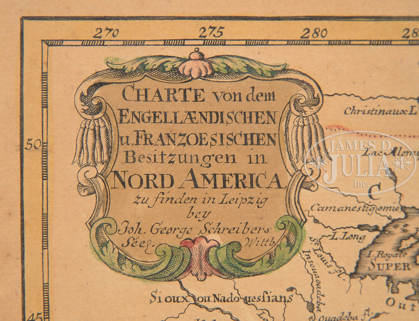
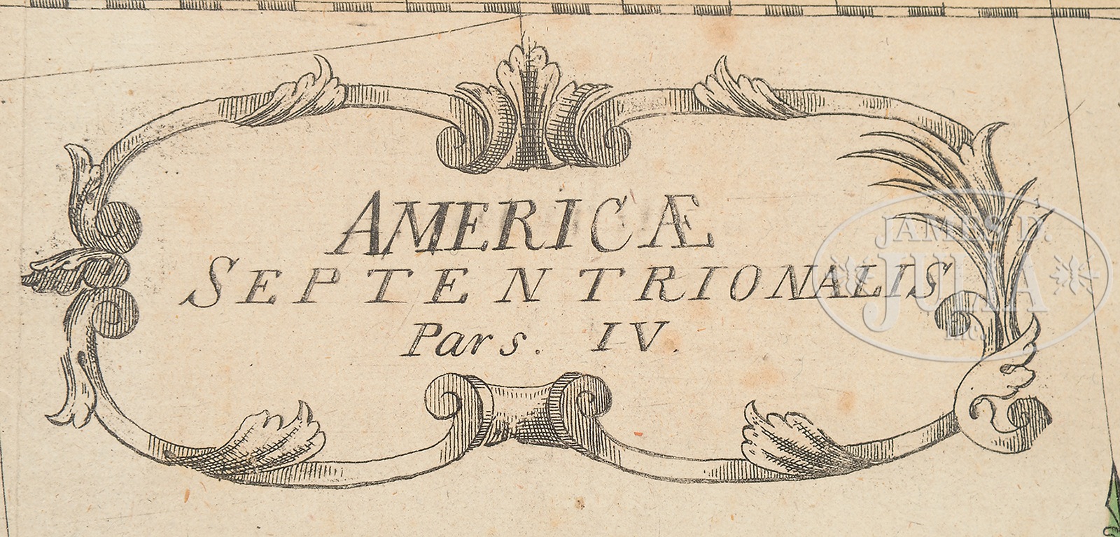
FOUR MAPS OF NORTH AMERICA TOGETHER WITH A MAP OF COOK’S VOYAGES.1) Jon. George Schreibers, late 17th Century. CHARTE von dem / ENGELL AENDISCHEN / u. FRANZOESISCHEN / Besitzungen in / NORD AMERICA. An early map showing North America naming ten colonies. In a modern frame. Lower left corner of sheet beneath map written in pencil script is “Circa 1680 (rare)”. 2) Probably Leonhard Euler, 1750. AMERICAE / SEPTENTRIONALIS / Pars. IV. This scarce German map of the Caribbean and Central America is part of a four-sheet map of North America. Each sheet stands alone with a decorative cartouche and full borders. The map is nicely detailed with place names in both German and English and shows many of the smaller islands, shoals and reefs. The map extends north to Cumberland Island, Georgia and west to Pensacola, Florida. Florida is quite narrow with southern Florida depicted as a series of large islands. A number of rivers and small lakes fill the peninsula. In contrast, there is little inland detail in South America, where Lake Maracaibo is given an elongated, narrow shape. The map with decorative title cartouche and a small compass rose. Housed in a modern frame. 3) Leonhard Euler, 1755. MAPPA/GEOGRAPHICA/AMERICAE/SEPTENTRIONALIS/ad emendatiora Exemplaria/adhuc edita/jussu/ACAD. REG. SCIENT. et./ELEG. LITT./descripta./Pars. II. The map delineates the following territories: Connecticut, Georgia, Maine, Maryland, Massachusetts, New Brunswick, New Jersey, New York, Newfoundland and Labrador, North Carolina, Nova Scotia, Pennsylvania, Prince Edward Island, Rhode Island, South Carolina, Vermont, Virginia. Housed in a modern frame. 4) German map illustrating the three voyages of Captain James Cook in the Pacific Ocean. Signed in script lower right facing beneath neat line “S. Benedicti”. 5) Robert Vaugondy, 1755. PARTIE / DE L’AMERIQUE SEPTENTRIONALE, / qui comprend / LE COURS DE L’OHIO, / LA NLLE. ANGLETERRE, LA NLLE. YORK, / LE NEW JERSEY, LA PENSYLVANIE, / LE MARYLAND LA VIRGINIE, LA CAROLINE. / Par les Sr. Robert de Vaugondy Geographe / ordinaire du Roi. / Avec privilege 1755 within cartouche. Copper engraving on paper with watermarks. Hand-colored borders. SIZE: 1) Map size: 6-1/2″ x 9-1/4″ in modern frame. 2) Map size: 13-1/2″ x 14-14″. 3) Map size: 13-1/2″ x 14-1/4″. 4) Map size: 21″ x17-1/2″. Sheet size: 28-3/4″ x 22″. 5) Map size: 18-3/4″ x 24-1/2″. Sheet size: 21-1/2″ x 27-1/4″. PROVENANCE: Private Central Maine Collection. CONDITION: 1) With overall toning and some minor foxing. Sheet trimmed. 2) With some foxing throughout and soiling to sheet borders. Map remains crisp and clear and housed in a modern frame. Sheet has been trimmed to map at top and bottom. 3) Colors somewhat faded. Borders remain clear. Slight toning and foxing throughout. Sheet has been trimmed to neat lines at top and bottom, otherwise good. 4) Map engraved on heavy paper with light toning, otherwise very good. 5) Light toning and soiling to sheet borders. Map good overall with no major issues. 49794-13 (2,000-4,000) – Lot 2196
Auction: Fine Art, Asian & Antiques - Winter 2016 Please Note: All prices include the hammer price plus the buyer’s premium, which is paid by the buyer as part of the purchase price. The prices noted here after the auction are considered unofficial and do not become official until after the 46th day. |